

By Angela Barbuti. Media: Nypost
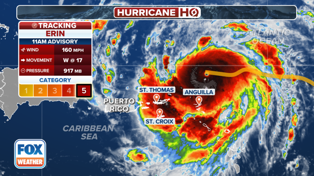
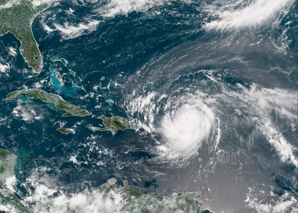
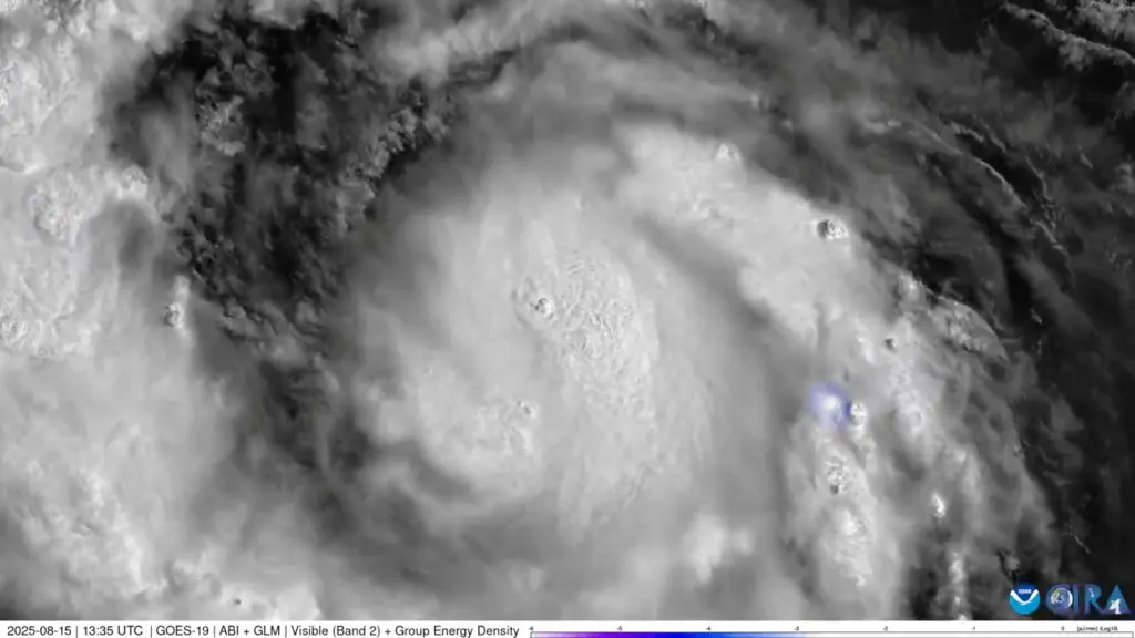
Hurricane Erin swelled to a Category 5 storm, the strongest category possible, in the Caribbean on Saturday — and it could cause “life-threatening surf and rip currents” on East Coast beaches early next week.
Erin rapidly grew from a tropical storm to a hurricane in just 24 hours, with winds doubling to 160 mph Saturday morning, the National Hurricane Center said.
Fox Weather meteorologist Cody Braud told The Post on Saturday that the storm will remain “rather strong” for the next two to three days — and it’s literally “up in the air” as to how high winds can get.
FOX Weather
NOAA/AFP via Getty Images
“That is highly uncertain at the moment. It has exceeded all expectations as of this morning,” he said.
“So it very well could get stronger. If it does, it won’t be that much stronger. Once you’ve gotten to the Category 5 range, there’s nothing really else to achieve besides higher winds or a lower pressure, which it may do.”
via REUTERS
Erin is expected to grow “three to five times as large” in size by the middle of the week, Braud said.
Although it will not directly hit the US, it is expected to cause dangerous surf conditions on the East Coast.
“We are expecting extremely large waves to slam into the East Coast all next week. And it will be very dangerous if anybody is deciding to venture out there. It will be highly discouraged to not be anywhere in the Atlantic waters next week,” Braud warned.
“As it moves north, the wind field in relation to the storm will drastically expand, and that’s going to cause potential beach erosion, life threatening surf and rip currents, and really coastal beach impacts from Florida all the way up to Maine.”

FOX Weather
As of Saturday, Erin was moving north of the U.S. Virgin Islands and Puerto Rico. It will then be moving to Turks and Caicos and the Bahamas.
“But before it gets there, it will start to recur north into the open Atlantic. And it will end, as it kind of moves in between Bermuda and the East Coast, mid-week to the end of next week,” Braud explained.
The nation’s protruding coastal areas, like Long Island, Cape Cod and the Outer Banks, are at a higher risk of direct and potentially severe tropical storm or hurricane conditions than much of the southern Atlantic, mid-Atlantic and northern New England coasts, AccuWeather said.

AP
The storm’s center is predicted to stay at sea without hitting land.
“It should more than likely stay over open water for the duration of its life,” Braud said.
Tropical storm watches were issued for St. Martin, St. Barts and St. Maarten, and heavy rain in those regions could cause flooding, landslides and mudslides.
Wind gusts from Erin, the first Atlantic hurricane of the year, can also hit the Turks and Caicos Islands and southeast Bahamas.
Hurricane season in the Atlantic started on June 1 and will last through the end of November. Erin is the fifth storm to be named this season.
The forecast for the season predicts up to 10 hurricanes, with three to five reaching major status with winds of more than 110 mph.


")


Discussion about this post